Excuse me. Please keep waiting for a time, as these reports have many pictures.
1996.3.31 (Reported by Takehiko Furuta)
For
PDF (you are readable this document in Portable Doument
Format.)

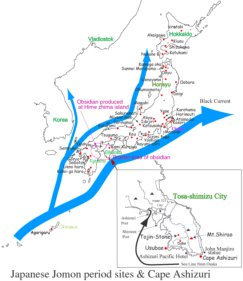
This Map is based on "Paleolithic and Jomon period
sites", and put on sites until just recently .
(THE CAMBRIDGE HISTORY OF JAPAN VOLUME 1 ANCIENT JAPAN THE EARLIST
SOCIETIES IN JAPAN THE JOMON PERIOD
p62 Map1.1 Paleolithic and Jomon period sites.
)
Ashizuri peninsula is located at the south end of Shikoku
island. The peninsula was made a long time ago, it surrounds the
433m high Hakuozan mountain made of granite which has moved up
and down many times. Kuroshio, the rough wave can be seen constantly
hitting the cliff. The Pacific ocean is very beautiful. When looking
down from the 88m high cliffs it feels like the water is pulling
you closer.
(Thanks. This information is offered by "HATA SIGHING MAP".
It is copyrighted by Yuko.)
More information is available at Sunfish.
For WWW information:
Japanese Jomon period sites
Please click on "REGION".
Jomon Site can also accessed from "Historical
Resource Guide for East Asia"
| REGION | WWW name Site mame |
| HOKKAIDO | non |
|---|---|
| TOHOKU | Sannai Maruyama Jomon Era File Index Sannai Maruyama |
| KANTO | non |
|
(include HOKURIKU,TOKAI) |
Famous Sites, Fauna and Flora Mawaki Archaeological Site and Chikamori Hamlet Site |
| KINKI | non |
| CYUGOKU (include SAN'IN) | non |
| SHIKOKU | - Sunfish Island - Cape Ashizuri |
| KYUSHU | The Archaeological Museum of Ibusuki city as a guide |
|
|
non |
Created by" Yukio Yokota"